Northwest Region
Canyon Pintado, CO
| by Tom Stockman |
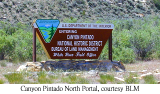
The "Painted Canyon" of the Ute and Fremont Native American tribes is an overlooked gem of Colorado's landscape, a region of American Indian pictographs & petroglyphs. Colorado Highway 139 traverses 70 miles between Fruita (near Grand Junction) and Rangely, and is the usual route to reach the better-known Dinosaur National Monument. Many who travel this highway are unaware of the wonders of Canyon Pintado. Scattered across the landscape are over 200 sites with the pictographs and petroglyphs. 16 different roadside sites are marked with signposts, but most people drive on by. Some sites take only a few minutes to reach on foot, others are more difficult. 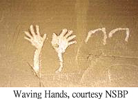
A pictograph is a painted design, some are depictions of birds & animals, people, and other features of the world, others represent thingsd more fanciful and less obvious. A Petroglyph is a carven image in stone, and like pictographs, might represent objects real or symbolic. At mile-post 53.5, look for the Waving Hands Site. A dark red figure waves from the cliff face with more smaller Fremont paintings, and around the corner to the south are a number of Ute figures, horses, arrows, and outlined hands sheltered under an overhang. 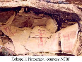
Then at mile 56, the Canyon Pintado Site (first described in 1776 by the Spanish Escalante expedition) is highlighted by a large depiction of Kokopelli, the famous hump-backed flute player of Anasazi mythology. This site first gave the Painted Canyon its name and is the highlight of the region. Another half-mile down the road is the White Birds Site, then at 57.8 is the Cow Canyon Site, with many petroglyphs; State Bridge Site is at mile 59.7. For the more active visitors, East Fourmile Draw at mile 67.6 has a 40-minute hike with archeological sites and displays, eventually reaching the Sun Dagger Site Camel Ridge Site at mile 70.5 has "anthropomorphic shapes" and abstracts 250 yards off the road. 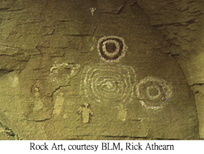
Many other sites are within easy reach from the highway, others are further in. Hikers will find a second or third look at a rock or cliff will reveal depictions that first looked like natural stone, and with over 400 known sites, exploration can be quite an adventure. Brochures are available in Grand Junction and Fruita providing details about the area, and this map from Rangely is a good resource (especially, two links at the top of that page lead to very useful, printable PDF files). Canyon Pintado is a magnificent outdoor museum spread over many acres and separate sites, overlooked by many on their way to better-known destinations. To those who take the half-day or so required to explore the 16 roadside sites, it's well worth the time. |
- Directions: I-70 to Fruita (10 miles northwest of Grand Junction), then take Colorado Highway 139 at mile-marker 15 north through Loma; the first site is Waving Hands at mile marker 53.5 on CO-139, then sites dot the highway to & beyond Rangely.
Back to Attractions List
Browse Previous Page or Next Page


