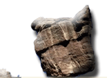
Denver Mountains Region
Mt. Evans, Idaho Springs, CO
| by Dawn Janov |

Here?s a way to get bragging rights that you?ve climbed one of Colorado?s famous 14?nrs (a mountain peak that is over 14,000 feet high) even though you are not exactly a fit and trained mountain climber. Drive up the Mt. Evans Road, the highest paved road in all of North America to the parking area, 14,130 feet high, and then hike the last 130 feet or 1/4-mile trail to the peak, 14,264 feet. All this beauty is just over an hour away from Denver. You may think that this is too easy, but the drive up from the entrance gate to the top really takes concentrated mental effort. The excursion to the top is a narrow two-lane road with lots of exhilarating switchbacks, unbelievable views, a little scary and an adventure that you?ll remember forever. In the early 1900s, cities competed for the Eastern tourist dollars by producing attractions. Soon after Colorado Springs completed the Pikes Peak Toll Road in 1888, a 16-mile road up the north side of the mountain, Denver was granted state monies to build a better, higher road up to Mt. Evans. 
Completed in 1927, it soon became the favorite attraction for those visiting Colorado. Denver Mountain Parks then built the Crest House at the top (sometimes called the Summit House) where tourists could enjoy a meal in the restaurant and buy gifts on top of the world with a fabulous view of Denver, the eastern plains and the surrounding mountains. When the Crest House burnt to the ground from a propane explosion in 1979, it was never rebuilt; however, today the remaining wall and foundation have been redesigned and serves as the observation platform. You can see all the way to downtown Denver, on a clear day some say you can see Kansas, row after row of mountain tops, and crystal-clear blue alpine lakes. As you drive up, open the window and note the temperature change that will drop 5 degrees every 1,000 feet. It may be 80?-90? in Denver and 50?-60? on top of Mt. Evans. Don?t be surprised if a majestic white Mountain Goat appears on the top of a nearby rock to statuesquely pose for a photo. Big Horned Sheep live here too, as well as Mule Deer, Marmot, Pika, Golden Mantle ground squirrel and an occasional bug. The best time to see the wildlife is early morning! 
Be careful when walking anywhere except the well-worn paths, for the hills are alive with fragile alpine flowers and plants. There are signs that remind you ?alpine flowers grow by the inch and die by the foot? (your foot). The best place to photograph the wildflowers is at Summit Lake just 5 miles back down the same road. There is a large parking lot, bathrooms and trails that lead among the multitude of wildflowers to the lake. The lake is surrounded on three sides by the high mountains. Across the road from the Lake is a permafrost area, the only place in the United States where the ground stays frozen all year except Alaska. This maybe the closest thing to perfection you can find in nature. As you come back down the mountain, be sure to visit the Mount Goliath Natural Area where the sub-alpine forest and the alpine tundra life zones mingle. Here you will find the largest growth of Bristlecone Pine trees, the oldest living thing on earth, some over 1700 years old. The oldest tree, at over 300 years old, is found in California. Rangers conduct 20-30 minute nature talks throughout the day. Take the time to include this informative and mesmerizing talk. Listen to the sound of songbirds that are abundant here as are the wildflowers. 
The best picnic spot is at Echo Lake at the entrance area. There is plenty of parking beside the road. Another parking area can be found at the end of the dirt road that leads to the backside of this deep blue lake. Fishing is good and it is stocked yearly. You may see artist with their easels and brushes around the lake. It is a favorite spot for art classes. Picnic tables and fire pits are available. Take the well-groomed trail around the lake and explore the nearby woods. End your day by watching the sunset reflected in the still water, breath the cool pine-scented mountain air, and be in no hurry to get back home. |
- Admission: Admission Pass valid for
3 days.
 Passenger per vehicle fee $10
 Annual fee $25
 Motorcycles Bicycles & hikers $3
 Golden Eagle, Golden Age, National Park Pass (with
hologram
 sticker)
No charge
 Mechanical collection machine for after hours $10
bring exact change
 - Hours: Open daily 24hrs from Memorial
Day to until the first significant
 snowfall,usually mid-September
 Early in the day is the best time to see wildlife
- Directions: off I-70 to"Mt. Evans" exit
#240 Idaho Springs
 15 miles on State Highway 103 to Mt. Evans Entrance
gate
 15 miles from Mt. Evans Entrance to Summit at 14,264
feet
 - Address: Clear Creek Ranger Station in Idaho Springs manages area
- Phone: (303) 567-3000 8am to 4:30pm
 Call for the most recent weather conditions at the
summit
photos used by permission Clear Creek County Tourism Board,
Idaho Springs, CO
Back to Attractions List
Browse Previous Page or Next Page


